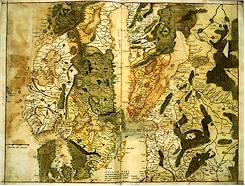
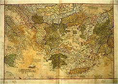
The seventeen unbound facsimile maps contained in The Mercator Atlas of
Europe are the only published images from the atlas available anywhere.
They have been painstakingly and faithfully reproduced and expertly
printed on heavy ivory stock. The result is a spectacular portfolio of
images of great beauty and historical significance.
 Each map represents a double folio sheet from the atlas itself and measures
21.625 x 16 inches.
 The following double folio sheets from the Atlas of Europe are included in
this limited edition of The Mercator Atlas of Europe.
Many are also available individually. Please see the Order page for details.
Click on the  icon
next to the folio sheet description to see a full image of the map.
|
SPAIN ("Hispania") 1554 |
 |
|
SCANDINAVIA ("Svetia & Norvegia regna") 1554 |
 |
|
ITALY ("Italia") 1554 |
 |
|
TURKEY & THE EASTERN MEDITERRANEAN ("Asia Minor") 1554 |
 |
|
SCOTLAND ("Scotia") 1564 |
 |
|
IRELAND ("Irlandia") 1564 |
 |
|
LOMBARDY ("Lombardiae") 1570 |
 |
|
TYROL ("Tirolis") 1570 |
 |
|
HERBRIDES & ORKNEY ISLANDS ("Herbrides & Orcades") 1564 |
 |
|
GERMANY ("Germania") 1554 |
 |
|
ENGLAND ("Anglia") 1564 |
 |
|
EUROPE ("Europae") 1569 |
 |
|
BRITISH ISLES & GREENLAND ("Britanni & Gronlan") 1554 & 1569 |
 |
|
GREECE ("Graecia") 1554 |
 |
|
CORNWALL & WALES ("Cornewallia & Wallia") 1564 |
 |
|
FRANCE ("Gallia") 1554 |
 |
|
UKRAINE and CRIMEA ("Sarmatia") 1554 |
 |
 The maps contained in Mercator's atlas of Europe are the most important
surviving body of Mercator's work in a single volume.
His new view of
Europe represented a major cartographic achievement, and for the next two
centuries it became the accepted picture of the continent, signifying the
beginning of a new geography.
 The atlas maps comprise the only surviving copy of Mercator's wall map
of 1554. It appears that Mercator required four copies of his wall map to
cut and paste these nine bound images. The atlas also includes the only
two known autograph manuscript maps by
Mercator (Lombardiae regionis Delineatio and Tirolis & pars Lombardiae).
In addition, the volume
contains one of only four known copies of Mercator's wall map of the
British Isles dating from 1564, the year of Shakespeare's birth,
as well as two sections of the rare wall map of
the world of 1569, which was the first map produced using the "Mercator
projection."
 The maps of the British Isles illustrate the unfolding knowledge of the
shape and nature of Britain in the mid-sixteenth century and contain the
first detailed and reasonably accurate representation of its four parts.
Recent study by scholars at the British Library indicate that the original
maps used to draw the wall map of the British Isles were almost certainly authored by
John Elder, whose Catholic and Scottish sympathies and antipathy to the
humanist culture exhibited by the Court of Elizabeth provide every
indication that the map may well have been designed as a tool for
invasion.

